Underwater Monitoring Operations
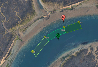
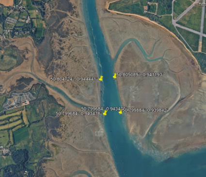
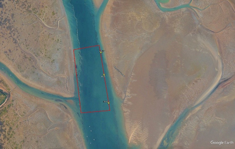
1. Mariners are advised that underwater monitoring will be taking place within the Chichester and Emsworth Channels on Monday 30th March (subject to weather). The equipment will be deployed by fishing vessel Angelle Marie and marked by sets of 3 yellow/orange unlit buoys at both locations.
2. The monitoring equipment will be in place for 1 hour over the high tide period.
3. Chichester Channel between Roman Port Lateral Marker and Chalkdock Starboard Marker along the following set of co-ordinates:
Lat. 50°48’35.73″N Lon. 0°53’6.83″W
Lat : 50°48’32.19″N Lon : 0°53’21.12″W
Lat. 50°48’25.83″N Lon. 0°53’31.43″W
4. Eastern side of Emsworth Channel – In the vicinity of Verner, between the following co-ordinates:
Lat. 50°48’18.32″N Lon. 0°56’28.29″W
Lat. 50°47’59.58″N Lon. 0°56’23.43″W
The monitoring will form part of a nature recovery project within Chichester Harbour as part of the Solent Seascape Project.
5. Mariners are advised to keep clear of the fishing vessel and buoys.
6. Cancel this notice on 1st April 2026.
Captain Jo Cox
Harbour Master
26 April 2026