Cycling is a great way to explore Chichester Harbour. As well as being a good form of exercise, cycling has lots of benefits for the environment too. The Harbour has a range of dedicated cycle paths and bridleways which are all suitable for those on two wheels, and offer stunning sights along the way.
If you get into trouble then a Cyclepods Repair XL kit can be found at the front of the Harbour Office at Itchenor to help carry out basic repairs such as repairing a puncture to adjusting brakes and gears.
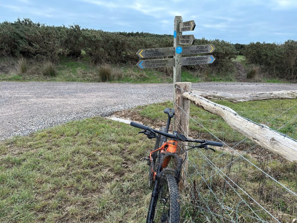
If you are using a bike in Chichester Harbour please don’t cycle on public footpaths.
The past few years has seen a rise in cyclists using waterside footpaths which are designed for walkers only. Cycling on these footpaths is causing damage which is difficult and costly to repair so please stick to roads, cycle paths or bridleways.
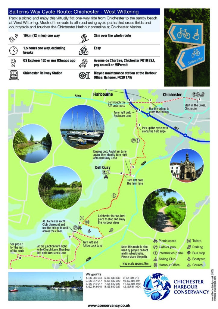
The Salterns Way cycle route
The Salterns Way is a 12 mile cycle route from the centre of Chichester to the sand dunes of East Head. Some of the route is on dedicated cycle paths and other sections follow country lanes and some roads.
Please:
- Follow the Salterns Way signage along the route
- Avoid cycling on the field margins or on footpaths
- Use the gates provided and close them after you have passed
- Take extra care on the roads along the route as they can sometimes be busy
Other suggested routes
-
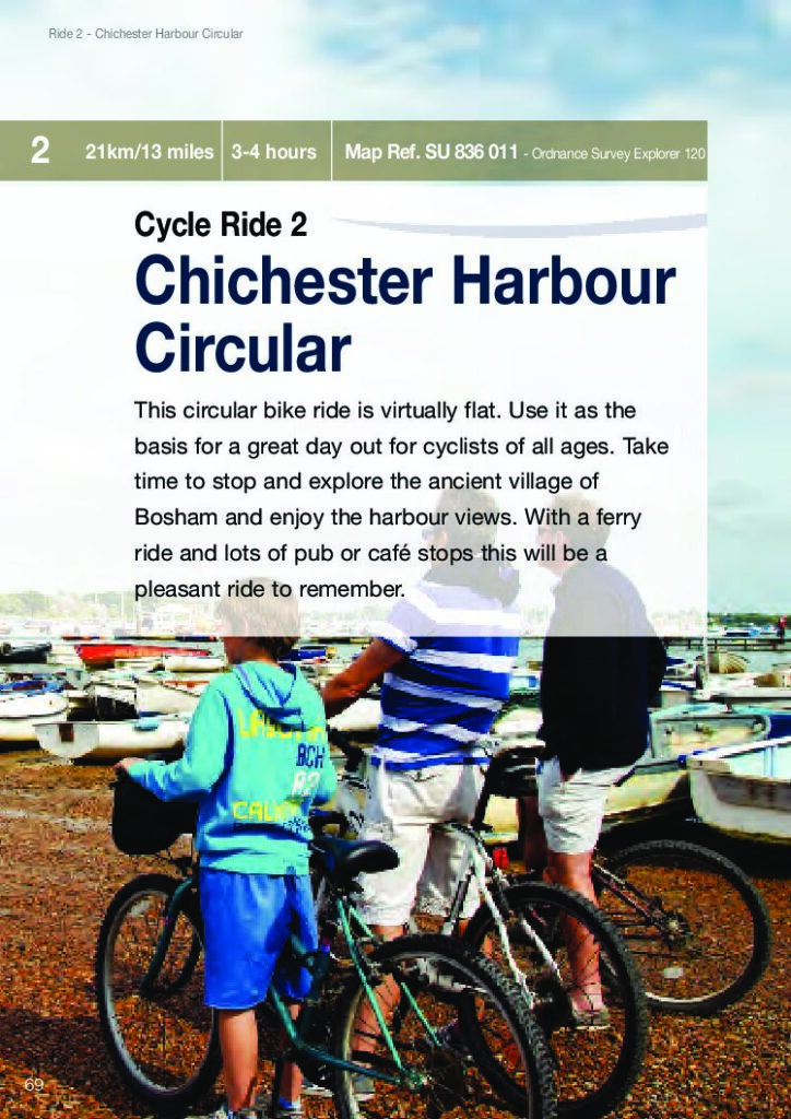
Chichester Harbour Circular – 21km/13 miles A virtually flat circular bike ride. Use it as the basis for a great day out for cyclists of all ages. Take time to stop and explore the ancient village of Bosham and enjoy the Harbour views. With a ferry ride and lots of pub or café stops, this will be a pleasant ride to remember.
-
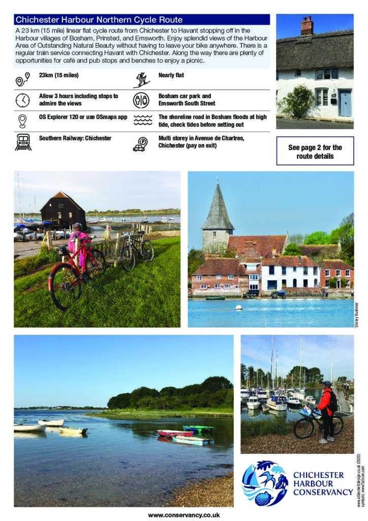
Chichester Harbour Northern Cycle Route – 23km/15 miles A linear flat cycle route from Chichester to Havant stopping off in the Harbour villages of Bosham, Prinsted, and Emsworth. Enjoy views of the AONB without having to leave your bike anywhere. A regular train service connects Havant with Chichester, and there are plenty of opportunities for café and pub stops and benches to enjoy a picnic.
-
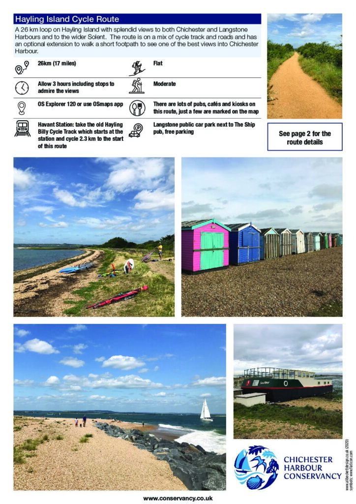
Hayling Island Cycle Route – 26km/16 miles A loop ride on Hayling Island with splendid views to both Chichester and Langstone Harbours and to the wider Solent. The route is on a mix of cycle track and roads and has an optional extension to walk a short footpath to see one of the best views into Chichester Harbour.
Cycling in Hampshire and West Sussex
The counties of Hampshire and West Sussex offer some great cycling opportunities. Plan your next route by visiting Cycling in Hampshire or Cycling in West Sussex.