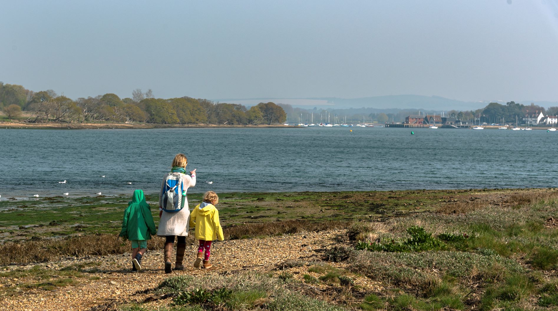
With 56.5 miles of footpaths, Chichester Harbour is a wonderful place to enjoy the brighter weather of spring. However, some footpaths are more exposed than others to extreme weather and high tides, resulting in occasional instances of erosion as seen in the wake of Storm Kathleen earlier this month. When required, the Highways Authorities (the County Councils) have powers to close a footpath if it is deemed necessary.
Here is an update on access to the footpaths around Chichester Harbour, correct as of 29 April 2024:
Fishbourne:
Footpath 3059 is located south of Fishbourne, along the sea wall near Appuldram. The sea wall suffered severe damage during Storm Eunice in 2022, and the footpath was closed. An adjacent route, Footpath 555, is popular with walkers and a boardwalk installed by Chichester Harbour Conservancy ensures the coastal route remains accessible here. Chichester Harbour Conservancy and its partners are developing plans to create saltmarsh habitat here, maintaining access with either a raised boardwalk or an earth embankment.
Bosham:
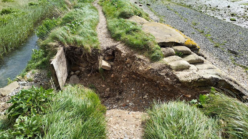
Footpath 230 at Colner Creek has already been closed for several months due to damage to the sea wall. The extreme weather in April further exacerbated the access issues, with additional damage recorded to the footpath. Conversations are continuing with the landowner, it is currently unclear when the matter will be resolved, therefore the footpath remains closed for the foreseeable future.
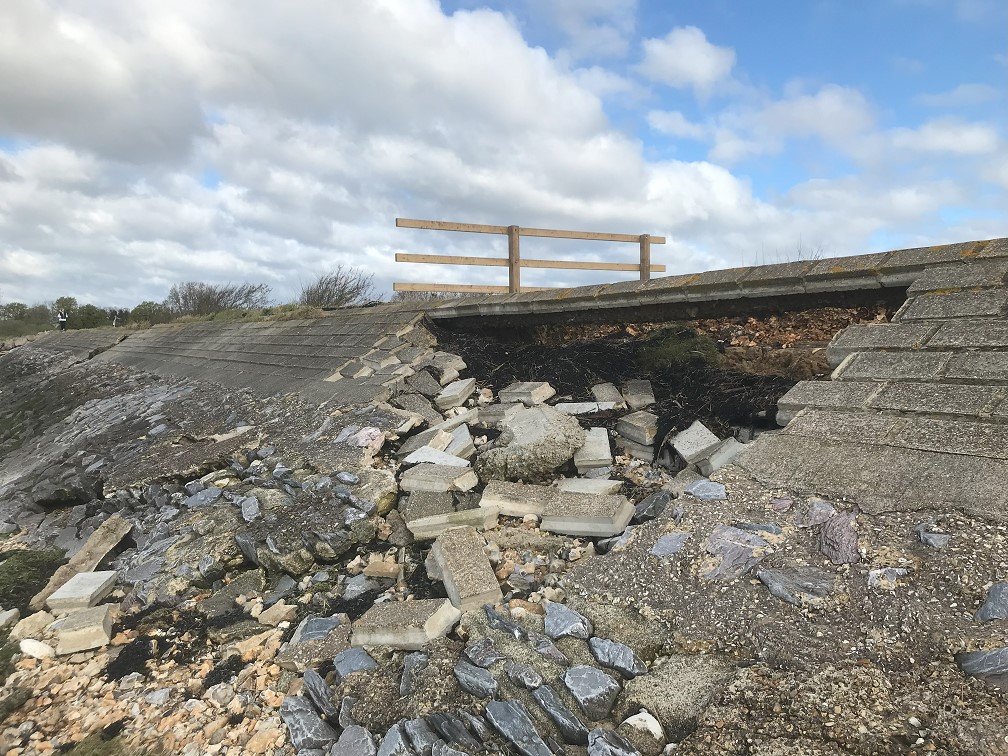
Cobnor/Chidham:
A stretch of Footpath 224 north of Cobnor in Chidham and Hambrook suffered two instances of landslips during Storm Kathleen and will be closed soon. An Officer from Chichester Harbour Conservancy visited the site with the landowner; discussions are taking place with the Highways Authority to identify a solution.
Thorney Island:
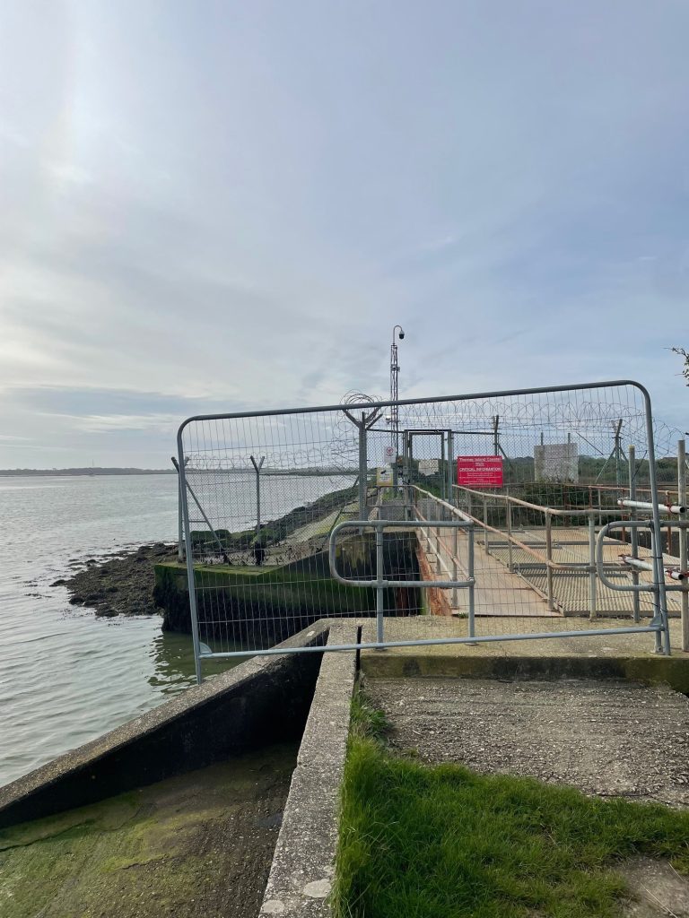
The circular route around Thorney Island is one of the most popular Chichester Harbour walks and provides spectacular views of the harbour entrance. However, Footpath 202 has been closed for several months due to an issue near the eastern gate. In 2023, there was flooding on the Island due to a failure of the sluice gate. Discussions took place between the landowner, the Environment Agency, and Southern Water, about fixing the sluice gate and the ongoing responsibilities for the asset.
Since these discussions have not yet concluded, the footpath is not yet in a condition whereby the Highways Authority can re-open the route. This is a source of frustration to Chichester Harbour Conservancy and we hope the issue will be resolved in the near future.
Nutbourne
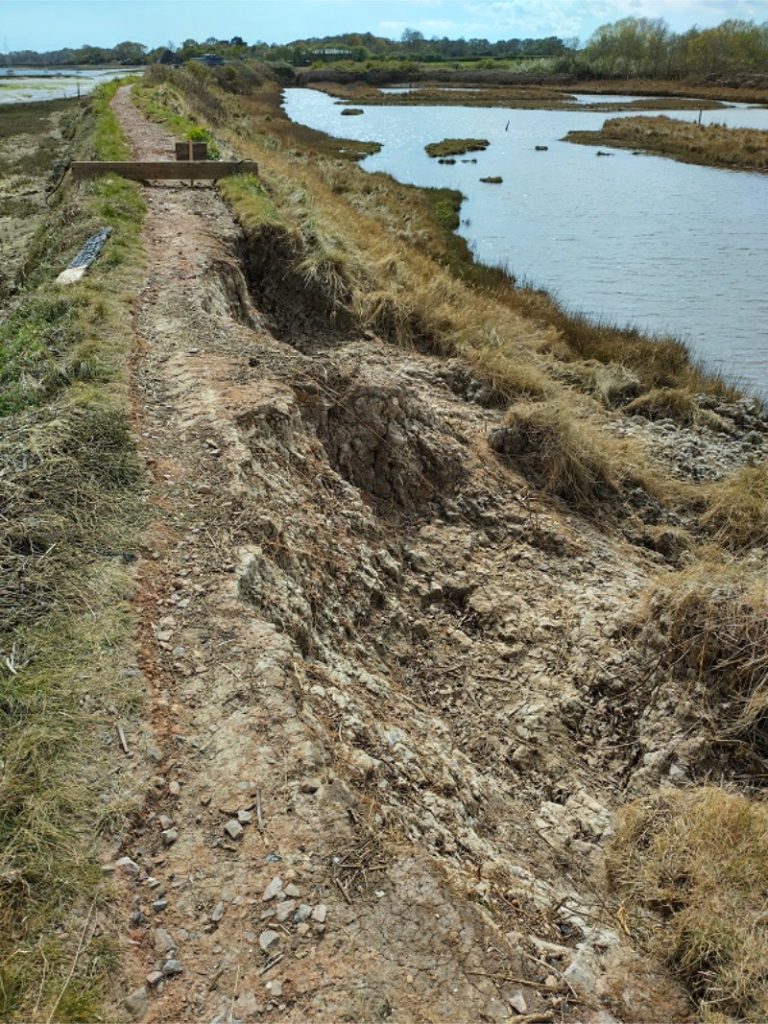
Over the winter, the seawall under footpath 202 south of Nutbourne has suffered damage and was closed a few months ago. This damage worsened during Storm Kathleen.
Langstone:
Footpath 108/56/2 is the coastal route at Langstone, between Wade Lane and Langstone Mill Pond. Although the sea defences here collapsed a couple of years ago, the path has proved resilient and has remained open. Earlier this year, Chichester Harbour Conservancy, Coastal Partners, Hampshire County Council, and Natural England agreed to pursue a footbridge in this location, as a way of adapting the site to sea level rise and putting the foundations in place for future saltmarsh habitat creation. Hampshire County Council are leading with this work, with Chichester Harbour Conservancy keen to progress matters as soon as possible. Although the millpond wall was overtopped during Storm Kathleen, the wall held up.
Hayling Island – Mengham Rythe
We have been informed by Hampshire County Council that Footpath 108/510/1 near Mengham Rythe Sailing Club may be considered for a temporary closure notice. This follows the flooding of Mengham Rythe Sailing Club and its car park due to Storm Kathleen.
The Future:
Historically Chichester Harbour Conservancy and its partners stepped in to repair sea defences when damaged by storm events. However, in the wake of the Natural England condition review into the Site of Special Scientific Interest in 2021 it became apparent that the abundance of hard sea defences were causing significant damage to the natural harbour environment. As sea levels rise, hard sea defences block the gradual migration of saltmarsh inland, as well as cutting off the sediment supply to the harbour, effectively “squeezing out” precious saltmarsh habitat. This process is known as “Coastal Squeeze”. Nearly 60% of Chichester Harbour’s saltmarsh has disappeared since the 1940s.
However, with progressive and an adaptive approach to coastal management, we can return Chichester Harbour to the natural beauty that it was 50 years ago.
Chichester Harbour Conservancy would like to see the full 56.5 miles of footpath open and available for the public to use. We are committed to maintaining the amenity of the harbour environment, in balance with protecting our National Landscape and natural habitats. The conservation of Chichester Harbour is critically important as we live in a biodiversity and climate crisis. Footpaths will need to be rolled back in places to allow space for natural habitats whilst maintaining access to this unique landscape, providing a closeness to nature within the largest natural estuary in south-east England.